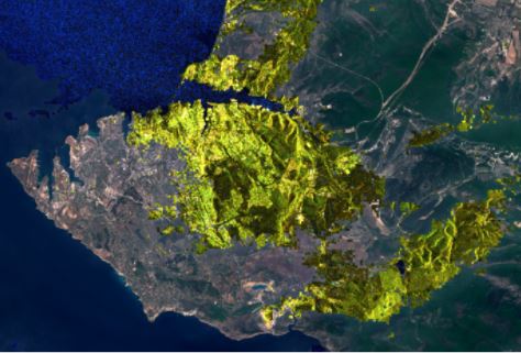
Through information solutions based on the use of satellite photos, the application of classification models and the implementation of machine learning algorithms, it is possible to optimize the management of large plantations and minimize the risks faced by crops that affect profitability per hectare planted.
The growing availability of data that exists today is leading companies to seek new ways and tools to take advantage of this huge wave of information that is being generated in different business sectors.
See “Big Data in times of crisis“
Agricultural activity is not exempt from these problems. Until now, through the use of drones and the analysis of low resolution satellite images it was possible to solve some typical problems of the sector: observation and general analysis of plantations, detection of large weed outbreaks, among others. But now, the tools used until now are beginning to be limited in their capacity to manage the “new wave” of information, for which not only other tools are needed, but also other scientific skills and another technological infrastructure for processing all this data.
The work teams of agricultural companies that work with a “data driven” approach have found in Business Intelligence solutions based on the analysis of satellite photographs, a tool of great value to reduce the risks in the investments they make in their crop fields. The following is a real case in which PREDIK Data-Driven had the opportunity to provide its services.
Problem to be solved
A corporation in the agricultural sector, dedicated to the cultivation of pineapple, needed to improve its process of identifying the threats faced by its plantations through the analysis of high-resolution satellite images.
Our Business Intelligence Solution
In order to solve this problem, PREDIK Data-Driven developed a model that has the capacity to classify satellite images, a tool that helps to detect different types of threats faced by the company’s plantations, from illegal invasions of the land and theft of seeds or bulbs, to the identification of weed outbreaks, among others.
For the start-up and implementation of this solution, various methodologies were used, combining the use and analysis of high-resolution images with the application of machine learning algorithms.
Methodology and data sources used
The methodology used for the development of this solution consisted of the application of image classification models. These models focus on detecting and characterizing, in the satellite photographs, all the elements that are of interest to the user, regardless of their size. Once this process is done, the data is introduced into a classification model that, as it processes more information, is “trained” more and more, increasing the degree of accuracy of the results.
With the implementation of this model and combined with the application of machine learning algorithms, a solution was generated that allowed the business group to identify, practically in real time, the specific areas of the plantations that face the greatest threats.
You may be interested in “Big Data to Profile Consumers“
What added value is generated by this type of solution?
The company immediately identified the areas where its crops faced risks and focused on optimizing its control processes, thus reducing losses caused by these factors and optimizing profitability.
Contact us to get more information about our business intelligence solutions


