Through solutions based on the analysis of satellite photos and machine learning models, it is possible to optimize the process of identifying the best land uses and analyze the areas where a construction project will be developed with a high level of detail, in order to find the optimal location and minimize investment risks.
The accelerated growth in the availability of data and the solutions and technologies being developed to take advantage of it is directly impacting all industries, and the real estate and construction industry is no exception.
The way real estate project feasibility studies are now being conducted is changing with the arrival of these new technologies and Big Data management tools. It is now possible to take advantage of the techniques being developed to collect and analyze satellite images, to transform them into data of value in the decision-making process of projects.
You might be interested “Agriculture: Solutions Based on Satellite Imagery”
Although in the past it was possible to analyze aerial images to determine, for example, whether an area was industrial, commercial or residential, today with the use of high-resolution satellite images it is possible to deepen the analysis and obtain more information to help developers of real estate projects to select the right site for the construction of a new property.
Real estate developers working with a “data driven” approach, have found in Business Intelligence solutions based on the analysis of satellite photographs, a valuable tool to reduce the risks in the investments they make in new projects. The following is a case in which PREDIK Data-Driven had the opportunity to develop a business intelligence solution with a 100% data-driven approach.
Problem to be solved
A residential project developer group required to reduce investment risk by identifying the ideal site to build a luxury apartment tower.
Our Business Intelligence Solution
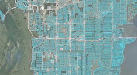
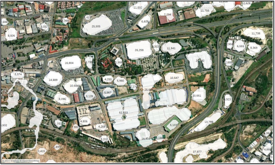
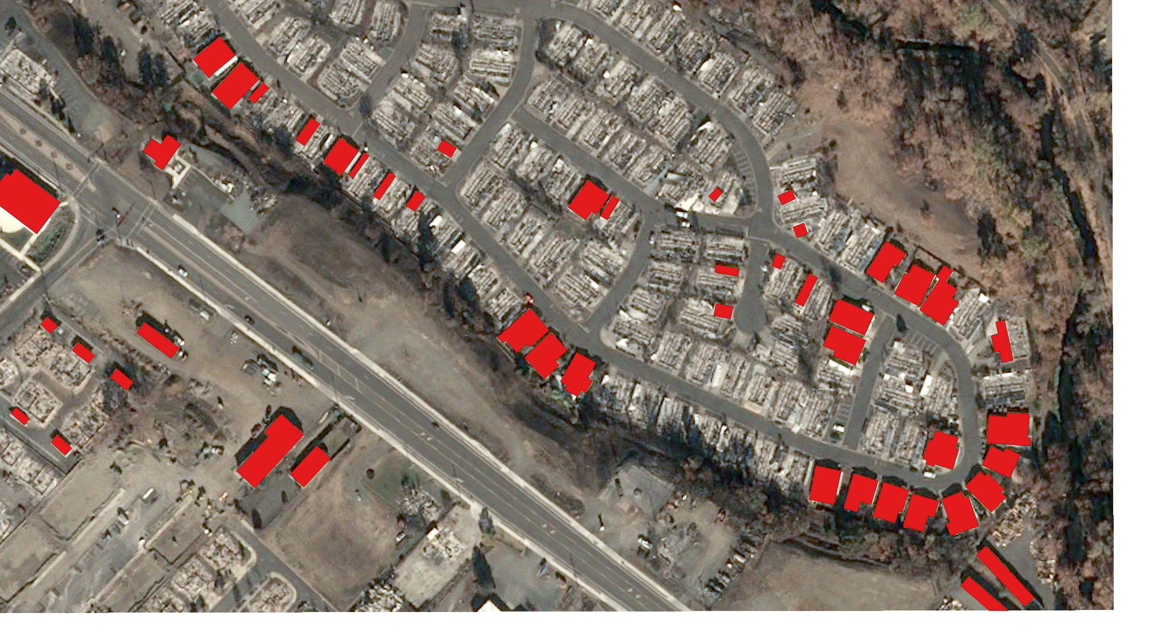
In order to solve this problem, PREDIK Data-Driven developed a model able to identify and analyze, by means of high resolution satellite images, the type of infrastructure existing in the different areas of the city where the developer group intended to invest.
For the start-up and implementation of this solution, various methodologies were used and the use and analysis of high-resolution images was combined with the application of machine learning algorithms.
Methodology and data sources used
The methodology used for the development of this solution consisted of the application of image classification models and analysis of past and current satellite photos, which allowed us to know the areas that have shown the most real estate development in recent years. These models focus on detecting and characterizing, in the satellite photographs, all the elements that are of interest to the user, regardless of their size.
This makes it possible, for example, to identify not only how many buildings and their characteristics there are in an area, but also to identify how many parking spaces they have, whether or not they have recreational spaces and their characteristics (such as the size of swimming pools, for example), whether they have solar panels and their size, among other details. With these models, for example, it is possible to infer, without having access to the plans, what is the built area of each of the buildings identified in the images.
See “Big Data for Educational Services Market”
By implementing this model and together with the application of machine learning algorithms, a solution was generated that allowed the business group to identify the specific sites in the city that have had the most real estate development, distinguish the types of infrastructure existing in each area at the highest level of detail, and estimate the construction areas.
This data was complemented with property valuation information and analysis of the areas’ commercial environments.
What added value did this solution generate?
The company immediately identified the ideal areas to build a luxury apartment tower and focused on adjusting the project to the market conditions in that area, reducing the risks that could be caused by exogenous factors and optimizing the return on investment.
Contact us to get more information about our business intelligence solutions