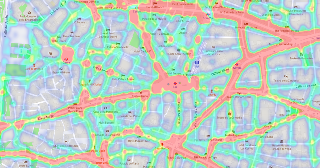
Foot Traffic analytics can identify the characteristics of transit stops and routes, helping to determine and improve the overall coverage of any transit system.
When it comes to public transport, foot traffic analytics can be of great help to authorities, who are faced with various challenges such as road congestion and the diversity of modes of transport, among others. This poses difficulties for public transport managers and operators when it comes to planning.
Now, with analytics generated by geospatial data, transit authorities can get a great help in planning and optimizing service management.
Also Read: “Foot traffic analytics for urban mobility solutions“
Here are the Top 10 uses and applications of foot traffic analysis for public transport:
- Understanding the service level.
Allows modeling of public transport service based on schedules using a geospatial data models and mobility analytics, this can answer questions such as the following:
- What area of the city can people reach in different time periods on both by walking and taking the public transport?
- What is the optimal location for a new service?
- How to identify the role of public transport in food accessibility, or calculate accessibility to work in different neighborhoods?
- What type of employees should I target for ridesharing incentives?
2. Improve level of service
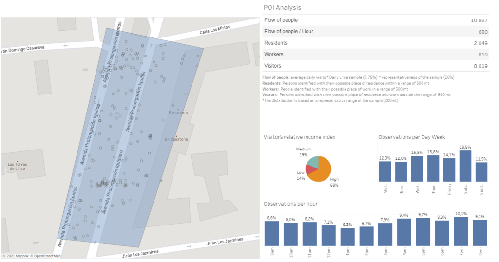
Enhance the level of service by calculating the frequency of transit service available for each stop, area of the city or point of interest, identifying the calculated average trip or number of trips available per hour with demographic data to know who transit serves, who is well served, and who has no transit service at all.
3. Evaluate public transit by measuring traveler behavior.
Allows to calculate travel time along the edges of transit lines by accurately identifying travel time, allowing to estimate the number of transfers used by the traveler, identifying the time or distance traveled by the traveler separately from the total travel time.
4. Measuring public transport data in real time
Foot traffic analytics with real-time public transportation data enables improved trip planning and innovative passenger-oriented applications.
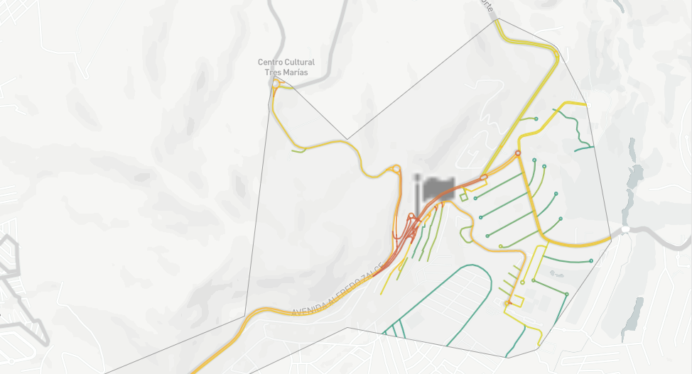
5. Improve transportation infrastructure
Enables more efficient infrastructure design, to accommodate a more multimodal transportation system, by obtaining combined data from buses, trains, subways, transit-adjacent parking, tolling systems, and even bicycle traffic.
6. Forward planning with predictive modeling
Identifies the potential positive and negative impacts arising from any proposed changes to transportation infrastructure, enabling a more decisive and accurate plan for the future to be generated in less time, helping transit authorities create new travel routes, or modify existing ones to maximize ridership.
7. Optimizing operational efficiency
Because data analytics tools calculate in real time, identifying operational inefficiencies becomes more accurate and timely, instantly alerting transit executives to declining ridership and guesswork, accelerating corrections and modifications.
8. Effectively manage traffic and improves road safety.
By leveraging the value of new location data streams and spatial analytics, it enables optimized urban traffic management operations and reduced CO2 emissions, while identifying the status of transportation networks at a deeper granularity than ever before.
9. Mobility planning
Analysis of travel patterns through origin-destination matrices and spatial modeling enables cities to provide the right services to the people who need them most.
10. Citizen services
Spatial data collection and visualization enables citizens to share information about road safety, congestion and more, allowing them to make more informed mobility decisions.
At PREDIK Data-Driven, we help public transportation managers deliver more reliable solutions by relying on analysis strategies that use a combination of geospatial and historical data.
Like what you see? Request a Free DEMO