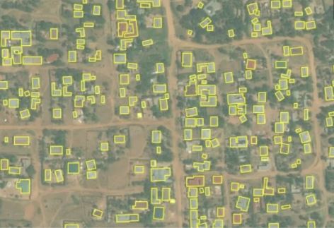
With the technologies available it is possible to use satellite photos to detect types of surfaces and roofs, objects, land use and variance in farmland, and then analyze the results and transform them into useful data for business decision making.
In the past, it was possible to establish whether an area was industrial, commercial, residential or agricultural by analyzing aerial images, but today, with the use of high-resolution satellite images, more information can be obtained.
With more sophisticated techniques, the use of updated technological tools and the application of appropriate methodologies, it is possible to estimate construction areas or the evolution of a crop in a certain area.
According to Jose Luis Cardenas, R&D Manager of PredikData, for the collection of information that is valuable for decision makers, “… multispectral satellite images are used for various topics.“
Cardenas explains that currently, images of roofs and surfaces are used to detect land use, objects, as well as to determine their actual construction area or modifications to the structure.
Regarding the usefulness of this type of data extracted from images of roofs and surfaces, the specialist answers that “… the uses are very varied, from analysis of real built-up areas, detection of warehouses, detection of solar panels, to the progression of a crop.“
The implementation of these methodologies is a complex process, because to obtain the desired results, the use of multispectral images must be combined with the application of Machine Learning algorithms, said Cardenas.
Contact us to get more information about our business intelligence solutions