Specialized Datasets
Enriched geospatial dataset for data teams to get better market insights in target areas
Our dataset offers detailed and enriched information about the business, commercial, and industrial aspects of any particular area in the USA, including Point of Interest (POI) data and foot traffic. Data is organized into 150×150 sqm areas (geohash 7) and includes over 50 variables.
Leading Global Brands Trust Us


Get the insights you need to make better business decisions
Our dataset combines different sources, such as POI, places, and foot traffic data, and can be used for multiple purposes.
These include guiding retailers and FMCG brands in site selection, fueling marketing intelligence, analyzing trade areas, and assessing company risk. Additionally, our dataset has proved beneficial for real estate investment.
Start answering key questions


What is the visitors’ average income level in my target area?


Over 50 variables for better market analysis
Our dataset includes more than 50 variables, such as:
- Number of pedestrians seen in the area.
- Number of vehicles seen in the area.
- Average speed of movement of the vehicles seen in the area.
- Point of Interest (POIs) (in number and type) seen in the area (supermarkets, pharmacies, recreational locations, restaurants, offices, hotels, parking lots, wholesalers, financial services, pet services, shopping malls, among others).
- Average yearly income range (anonymized and aggregated) of the devices seen in the area.
Our dataset is designed to be easily integrated into your current models and can be delivered in different formats, such as .csv, to meet your analysis requirements.


A dataset ready to use
Our datasets have been processed, enriched, and tested so that your data team can use them immediately to train your ML models.
The high quality of our geographic information layers is the product of over seven years of work.
We have dedicated ourselves to the deep understanding and modeling of geospatial Big Data. Our standout feature is the GPS location of mobile devices, which we enrich with various alternative and public data.
Get personalized guidance
In addition to providing reliable datasets, we advise your analysts on their adequate implementation.
Our data scientists can guide your internal team on the optimal algorithms and models to get the most out of the information we provide (Without compromising the security of your internal data).

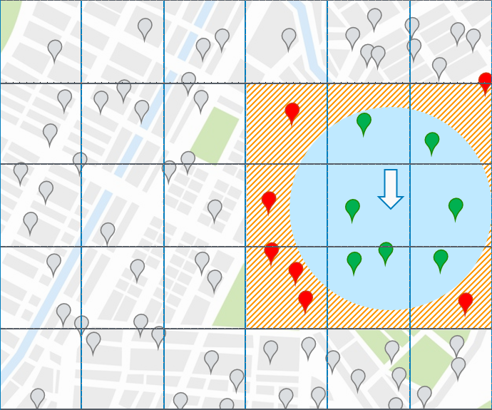
How efficient is a Geohash?
Geohash is a geofencing option that offers faster and more cost-effective data processing, providing users with actionable information. Its benefits include faster querying, reduced costs, minimal configuration, and ease of use.
A Geohash uses geocodes ranging from 1 to 12 characters. Users can split the dataset into variable-sized geohashes, with the default size being geohash7, which covers an area of 150m x 150m.
Start making the right decisions for your site selection strategies
Schedule a 30-minute meeting with one of our data experts to understand how can we work together and develop the perfect Big Data solutions for your organization.
Our solutions have helped some of the most important companies the US, Europe, Latin America, and Asia Pacific.